Share
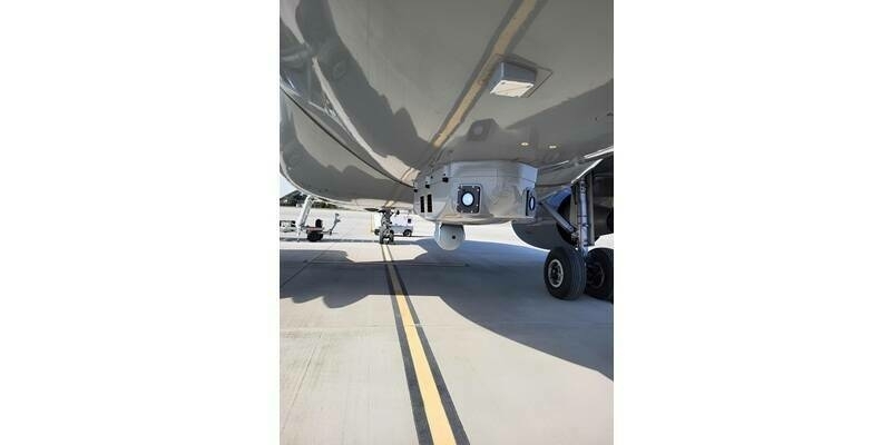
Terra Drone Indonesia, a group company of Japan-based Terra Drone Corporation, has successfully completed a pilot project with the newest addition to its technology arsenal – a drone equipped with Ground Penetrating Radar (GPR) system.
Working in collaboration with PT Airborne Geophysics Indonesia and the Geophysics Laboratory at the Bandung Institute of Technology (ITB), Terra Drone Indonesia flew the GPR-equipped drone at different altitudes and speeds to map tunnels and underground utilities at the ITB campus. The drone data was then processed and compared with the infrastructure records of the university by geophysicists. It was discovered that the GPR drone had accurately and precisely mapped the underground asserts.
The combination of GPR and drones opens up new potential for the use of unmanned technologies in areas that are traditionally both challenging and unsafe. For example, by scanning areas that have potential hazards, a GPR-equipped drone can be used to model post-blast areas in open-pit mines. In sectors such as construction and utilities, a GPR drone could be used to locate underground pipes, map the conditions of the assets, and detect hazards like pipeline leaks.
“The conventional GPR method requires field personnel to go to the field and carry GPR tools to conduct surveys. But this method has its own dangers because not only are some areas unsafe and difficult to reach but also because severe weather conditions in the field can hamper workers from carrying out their jobs diligently. GPR drones, in contrast, have emerged as a much safer and efficient surveying solution,” says Michael Wishnu Wardana, Managing Director of Terra Drone Indonesia.
It should be noted that Terra Drone Indonesia and ITB have joined forces to test new technological innovations several times in the past as well, including validating Terra LiDAR’s topographic mapping capabilities at ITB's Jatinangor Campus. The drone service provider remains open to collaborating with parties interested in its new GPR application.
Subscribe to our newsletter
Stay updated on the latest technology, innovation product arrivals and exciting offers to your inbox.
Newsletter