
Sepura Launch SmartView, Combining Indoor and Outdoor Location Reporting
21st October 2021
Sepura Launch SmartView, Combining Indoor and Outdoor Location ReportingNews as it happens! Keep in touch with the latest developments in business and technology in the regions or worldwide.
21st October 2021
Sepura Launch SmartView, Combining Indoor and Outdoor Location Reporting
20th October 2021
Geo Week Conference Program and Speaker Lineup Announced20th October 2021
Pinpoint: UK startup Naurt unveils first-of-its-kind location hyper-precise tracking software that improves GPS (GNSS)
20th October 2021
Creaform Introduces Three New Solutions to the R-Series Suite of Automated Dimensional Quality Control Solutions
19th October 2021
Globalstar Partner Advanced Tracking Surpasses Milestone of 2,000 SmartOne Devices Deployed in Leisure Marine Sector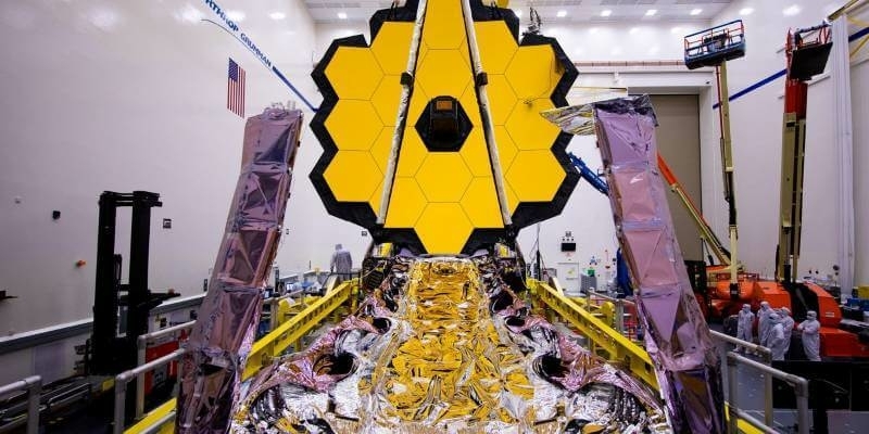
19th October 2021
Webb space telescope en route to the stars
19th October 2021
OGC and T-REX partner to bring Geospatial Innovation and Standards to St. Louis
18th October 2021
Yunex Traffic and HERE expand partnership to create proactive traffic management solutions
18th October 2021
1Spatial wins strategic government contract supporting Atkins to deliver NUAR following competitive tender
15th October 2021
SimActive Releases Version 9.0 with Distributed Processing
15th October 2021
Handheld announces new version of the NAUTIZ X6 ultra-rugged Android phablet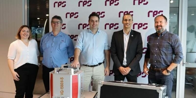
15th October 2021
New RIEGL VQ-1560 II-S for RPS in Australia
15th October 2021
Hexagon Streams Bluesky GB Aerial Photography via HxGN Content Program
15th October 2021
Arizona Department of Administration (ADOA) selects 1Spatial to support Next Generation 9-1-1 Buildout: GeoCollaboration of ADOA, AZ Department of Transportation and AZ State Land Department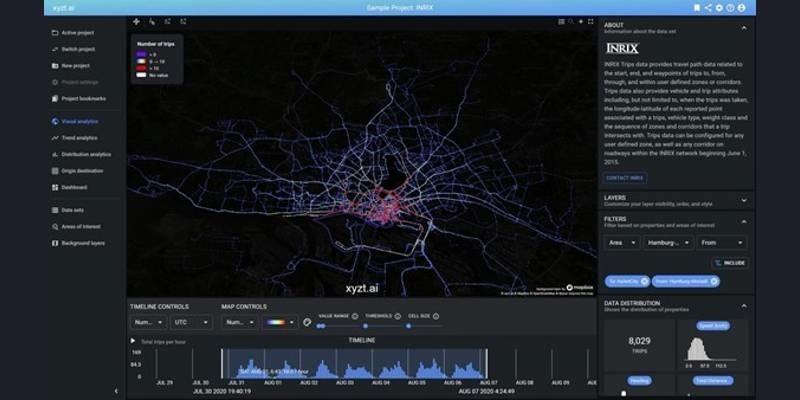
14th October 2021
xyzt.ai announces the availability of mobility data from INRIX on the xyzt.ai platform
14th October 2021
Yunex Traffic and HERE expand partnership to create proactive traffic management solutions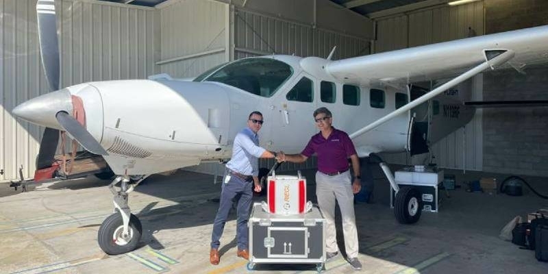
14th October 2021
Dewberry Acquires the Latest RIEGL VQ-1560 II-S Airborne LiDAR System
13th October 2021
Bentley Systems and SMRT Trains Collaborate to Improve Safety and Reliability of Metro Rail Services in Singapore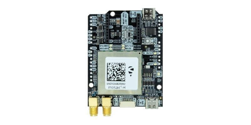
13th October 2021
Septentrio partners with ArduSimple, bringing reliable GPS/GNSS to emerging applications
13th October 2021
1Spatial supports major Northern Ireland government digital transformation programme
12th October 2021
DOF Subsea and Ocean Floor Geophysics Inc. form strategic alliance for global AUV services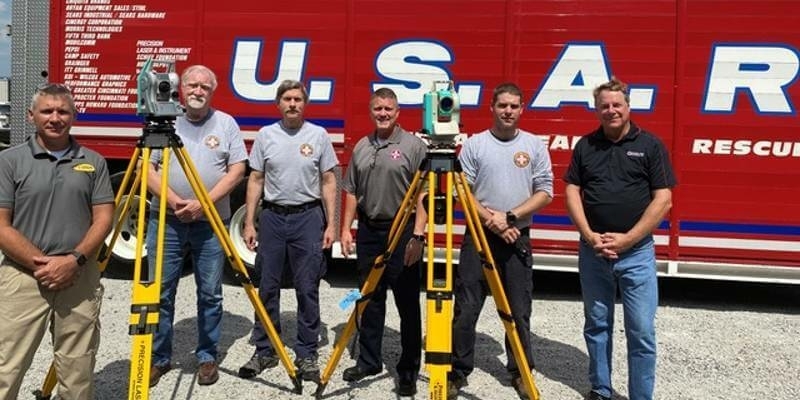
12th October 2021
Spectra Geospatial Donates Nikon Total Stations for Urban Search and Rescue
12th October 2021
Sateliot enters the U.S.A with the accelerator of giants Qualcomm and Verizon
11th October 2021
Last chance to register for Ocean Business 2021