
Global Mapper Chosen for Coastal Mapping Project
12th August 2016
Global Mapper Chosen for Coastal Mapping ProjectNews as it happens! Keep in touch with the latest developments in business and technology in the regions or worldwide.
12th August 2016
Global Mapper Chosen for Coastal Mapping Project12th August 2016
PCI Geomatics Releases Geomatica 2016 Service Pack 1
12th August 2016
KNect365 Maritime launches Shipping2030 Asia
12th August 2016
Bristow & Sutor Installs GreenRoad Solution12th August 2016
GIS Technology Proves Fundamental in Battle against Zika Virus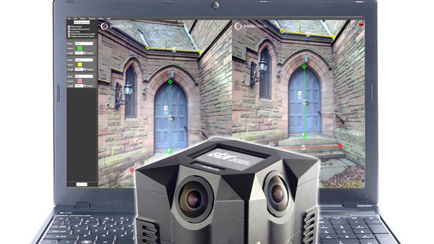
11th August 2016
New SphereVision 360 Imaging Software Integrates iSTAR Measurement Module11th August 2016
Impressive Speaker Line-Up for Luciad INTERACT11th August 2016
Critical Infrastructure Protection & Resilience Asia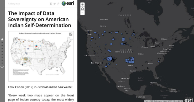


10th August 2016
ABPmer to help with decisions at aquaculture and fisheries R&D centre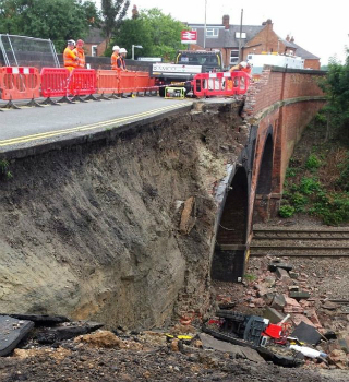
10th August 2016
Barrow Upon Soar Rail Closure Prompts Monitoring Calls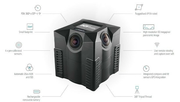
10th August 2016
iSTAR 360 degree Measurement Module integrated by imaging companies10th August 2016
MICROMINE's latest feature on Implicit Modelling
9th August 2016
Magenta Technology Gets Microsoft Gold for Echo Software.jpg)
9th August 2016
Fugro Specialists bring Expertise to Industry Roles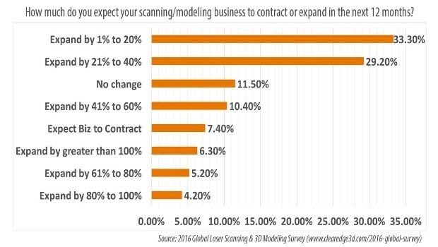
9th August 2016
78.7% of AEC Firms Expect Scanning/Modeling Work to Increase9th August 2016
OGC adopts SensorThings API Part 1: Sensing Standard
9th August 2016
indoo.rs revolutionizing the Indoor Positioning industry9th August 2016
Fugro to Showcase Structural Integrity Services

6th August 2016
Abu Dhabi to host industry giants at NATRANS Expo