News
News as it happens! Keep in touch with the latest developments in business and technology in the regions or worldwide.
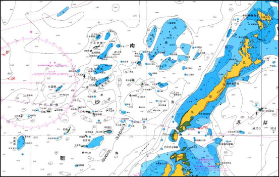
East View Expands South China Sea Imaging Capabilities
1st February 2017
East View Expands South China Sea Imaging Capabilities
Comprehensive Bathymetry and Marine Mapping Solutions
31st January 2017
Comprehensive Bathymetry and Marine Mapping Solutions
Popular Line of Miniature Inertial Sensors from SBG Systems
31st January 2017
Popular Line of Miniature Inertial Sensors from SBG Systems
Ordnance Survey International helps the UAE manage Climate Change
31st January 2017
Ordnance Survey International helps the UAE manage Climate Change
New Ordnance Survey Champion, Ben Fogle, urges nation to GetOutside
31st January 2017
New Ordnance Survey Champion, Ben Fogle, urges nation to GetOutside
New supported devices, flight missions, and mission settings
31st January 2017
New supported devices, flight missions, and mission settings
A Case Study on Long-Term Erosion Mapping in Northeast England
31st January 2017
A Case Study on Long-Term Erosion Mapping in Northeast England
Diamond Aircraft introduces new Garmin G1000 NXi Flight Deck
31st January 2017
Diamond Aircraft introduces new Garmin G1000 NXi Flight Deck
Esri Brings Operational Intelligence to 2017 DistribuTECH Conference
31st January 2017
Esri Brings Operational Intelligence to 2017 DistribuTECH Conference
ALGIZ RT7 ultra-rugged tablet now with Android 6.0 and 2 GB of RAM
31st January 2017
ALGIZ RT7 ultra-rugged tablet now with Android 6.0 and 2 GB of RAM
Successful Ground Trials of Volcanic Ash Detection
31st January 2017
Successful Ground Trials of Volcanic Ash Detection
Blue Marble Teams Up with Pointerra to Provide Cloud-Based LiDAR Data
31st January 2017
Blue Marble Teams Up with Pointerra to Provide Cloud-Based LiDAR Data
Bluesky Aerial Photomaps Help Keep Runners on Track
31st January 2017
Bluesky Aerial Photomaps Help Keep Runners on Track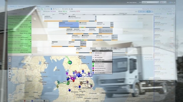
WorldStores Maps Out Optimised Routes with Maxoptra
31st January 2017
WorldStores Maps Out Optimised Routes with Maxoptra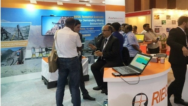
RIEGL’s Notable Week at Geospatial World Forum 2017!
30th January 2017
RIEGL’s Notable Week at Geospatial World Forum 2017!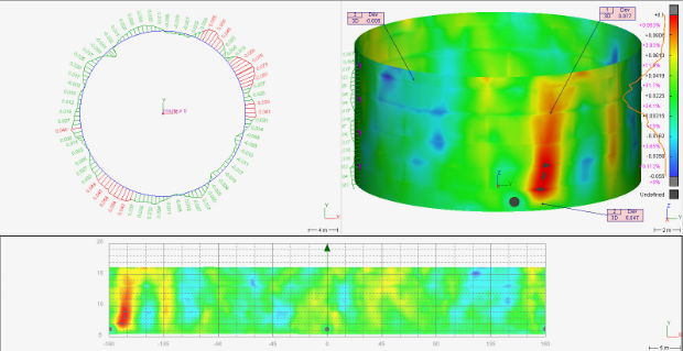

Cyberbit to showcase hyper-realistic cybersecurity simulator
29th January 2017
Cyberbit to showcase hyper-realistic cybersecurity simulator
LGA calls for lorry drivers to use commercial sat navs
28th January 2017
LGA calls for lorry drivers to use commercial sat navs
Lorry drivers must use commercial satnavs, say councils
28th January 2017
Lorry drivers must use commercial satnavs, say councils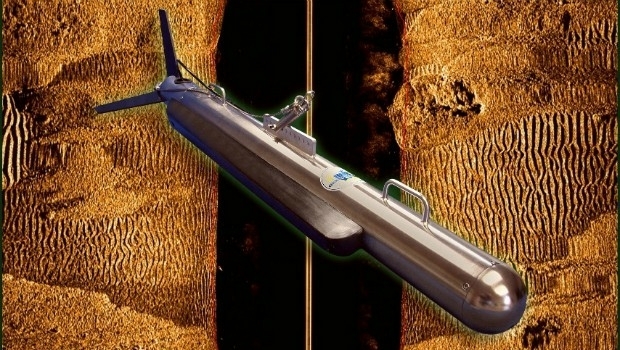
New High Performance Chirp Side Scan Sonar System
28th January 2017
New High Performance Chirp Side Scan Sonar System
Virtual World Asset Management delivered to the Power Industry
27th January 2017
Virtual World Asset Management delivered to the Power Industry