
RegioGraph: 2018 update available end of March
13th February 2018
RegioGraph: 2018 update available end of MarchNews as it happens! Keep in touch with the latest developments in business and technology in the regions or worldwide.
13th February 2018
RegioGraph: 2018 update available end of March13th February 2018
Assess the requirements to counter Drones in the Middle East13th February 2018
National Gendarmerie Conducts Post-Hurricane Missions with SimActive13th February 2018
Mauritanian HV Electric Transmission Corridor to be Surveyed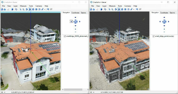
13th February 2018
ICAROS Uses TatukGIS SDK to Develop New Aerial Geospatial Data Viewer13th February 2018
AirGon LLC Appointed North American Distributor for YellowScan
12th February 2018
Bluesky Innovation Uses Mobile Phones to Create 3D Maps
12th February 2018
Airbus-built Aeolus successfully passes all tests in Liège (Belgium)

9th February 2018
GEOINT 2018 Registration and Housing Now Open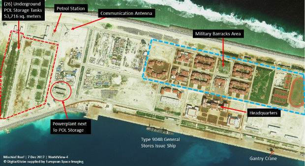
9th February 2018
Satellite images unveil Chinese military fortresses in Spratly Islands
9th February 2018
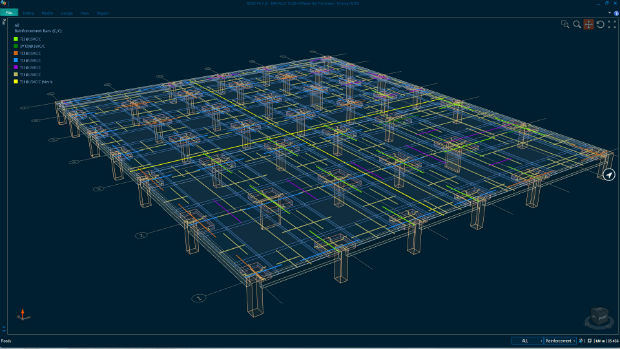
Bentley Systems Expands Concrete Building Design and Documentation8th February 2018
GSSI Proudly Announce Launch of New Website8th February 2018
PCI Geomatics Releases Geomatica Software Update
8th February 2018
CyArk and Phase One Partner to Preserve the World’s Cultural Heritage8th February 2018
thinkWhere Online Mapper Connects Aberdeen Bypass Project8th February 2018
Esri Releases Operations Dashboard for ArcGIS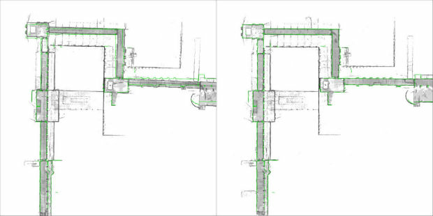
8th February 2018
NavVis sets new standard in SLAM precision8th February 2018
OGC Requesting Responses to its Portrayal Concept Development Study