
Matterport’s Digital Twin Platform Helps VRPM Design the Future of Modern Workspaces
5th February 2024
Matterport’s Digital Twin Platform Helps VRPM Design the Future of Modern WorkspacesNews as it happens! Keep in touch with the latest developments in business and technology in the regions or worldwide.

5th February 2024
Matterport’s Digital Twin Platform Helps VRPM Design the Future of Modern Workspaces5th February 2024
AntaRx-Si3: new inertial GNSS smart antenna from Septentrio
2nd February 2024
PCS looks to the future with IQGeo’s Network Manager Telecom2nd February 2024
Airbus Announces Purchase of Eutelsat OneWeb’s Stake in Satellite Constellation Manufacturing Joint Venture1st February 2024
Los Alamos National Laboratory orders second satellite from NanoAvionics1st February 2024
Norwegian Microsatellite Developed by Space Flight Laboratory (SFL) Achieves Optical Satellite-to-Ground Communications Link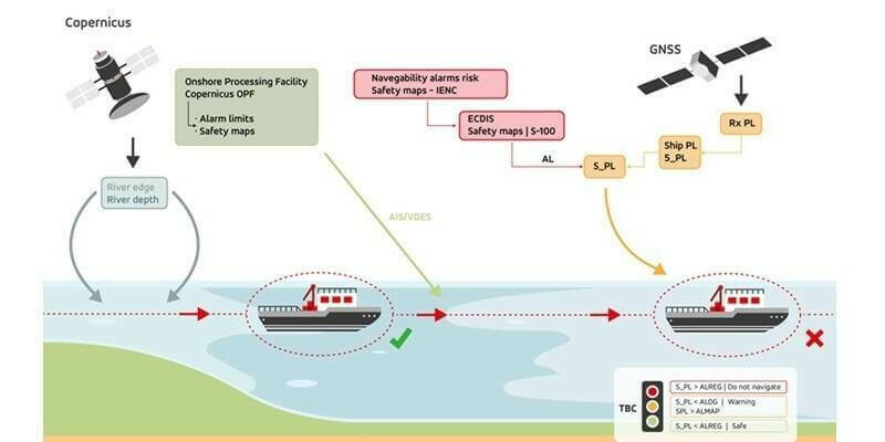
31st January 2024
GMV leads the AVIS project to optimize navigation for autonomous vessels
31st January 2024
MICHELIN Mobility Intelligence and Mapbox Join Forces to Enhance Road Safety in the UK
30th January 2024
ClearSkies Geomatics Adds New RIEGL VQ-1560 II-S to Support 2024 Expansion Plans
30th January 2024
1Spatial Announces new customer multi-year contract with European utility company30th January 2024
Paris Space Week 2024: Shaping the Future of the Space Industry
29th January 2024
dSPACE and Spirent Partner to Deliver Integrated Automotive Test Solutions
29th January 2024
Earth Blox prepares for growth in response to booming demand for nature and climate analytics
26th January 2024
HERE Technologies announces partnership expansion with what3words to enable seamless access and use across industries
26th January 2024
Teledyne to showcase new scientific imaging and machine vision solutions at SPIE’s Photonics West exhibition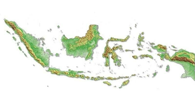
25th January 2024
Intermap Wins Major Indonesian Mapping Contract25th January 2024
Capella Space and Floodbase Partner to Bring High-Resolution SAR Data to Parametric Flood Insurers
24th January 2024
SimActive Announces Enhanced Cloud Capabilities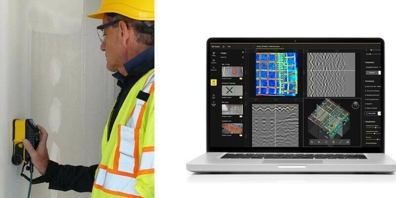
24th January 2024
IDS GeoRadar launches new concrete inspection solutions at World of Concrete
22nd January 2024
Hexagon's R-evolution launches Green Cubes: a digital revolution for rainforest conservation
22nd January 2024
The Mesa 4 Rugged Tablet by Juniper Systems is now available and shipping worldwide
19th January 2024
World Hydrogen MENA: Energizing the Clean Energy Revolution Across MENA Region
19th January 2024
Live Workshop: Photogrammetry in the cloud: is it a good idea?
18th January 2024
DTEK purchases STRYDE seismic system for Ukraine oil and gas exploration