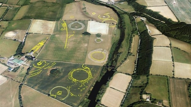
Bluesky Aerial Photographs Reveal Hidden Irish Archaeological Sites
30th January 2019
Bluesky Aerial Photographs Reveal Hidden Irish Archaeological SitesNews as it happens! Keep in touch with the latest developments in business and technology in the regions or worldwide.
30th January 2019
Bluesky Aerial Photographs Reveal Hidden Irish Archaeological Sites
28th January 2019
GeoPlace recognises ‘Britain’s Most Fantastic Address’
28th January 2019
Globalstar launches SPOT X two-way satellite tracker
28th January 2019
Maxoptra Routing Software Improves Snap-on Services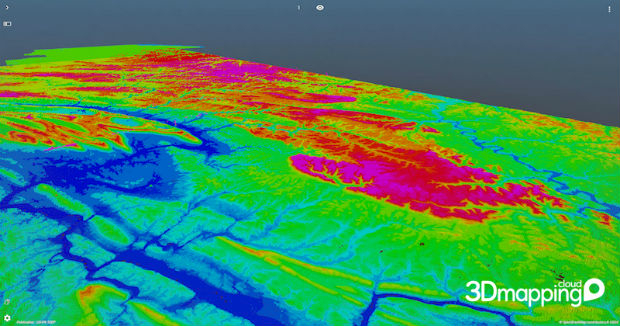
25th January 2019
Orbit GT brings 3DEP online on 3D Mapping Cloud
25th January 2019
Elaine Lewis becomes Non-Executive Director25th January 2019
CSA Recognized as PEC Safety Authorized Provider
25th January 2019
OGC Calls for Speakers for its Marine Summit in Singapore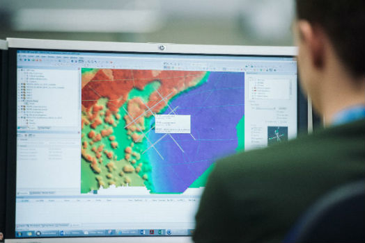
25th January 2019
UK Hydrographic Office welcomes Department for Transport’s Maritime 2050 strategy
24th January 2019
Sky and Space Global Shortlisted for the Best Mobile Innovation24th January 2019
Airbus completes System Requirements Review

24th January 2019
Leica BLK3D Recognised by Prestigious Global Awards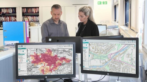
24th January 2019
thinkWhere Helps Falkirk Tackle Poverty with Open Geographic Data
23rd January 2019
New bathymetric capabilities with CARIS software23rd January 2019
Telefónica and Samsung Utilize LuxCarta’s Advanced Geodata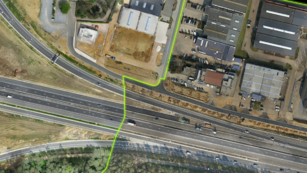
23rd January 2019
Virtual Surveyor 6.2 Now Processes Larger Drone Survey Projects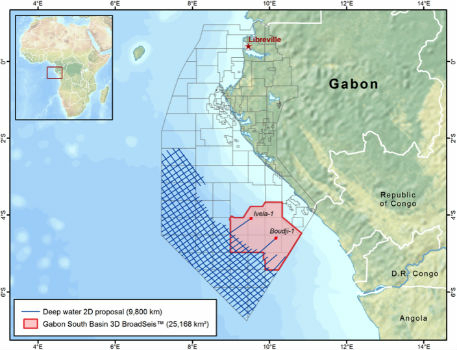
23rd January 2019
New CGG Survey Supports Gabon’s 12th Offshore Licensing Round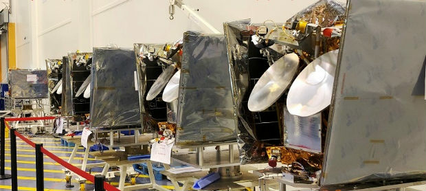
23rd January 2019
OneWeb Satellites has shipped first satellites23rd January 2019
Bridgestone Europe To Acquire Tomtom Telematics
23rd January 2019
Andy Boutle, Sarah Davidson & Shaun Farrell join the UK BIM Alliance21st January 2019
Geovation Programme returns for 2019 to help start-ups break through