RIEGL’s Market Presence Expands Through Distribution Partnership in Mexico with TTQ de Monterrey
23rd October 2020
RIEGL’s Market Presence Expands Through Distribution Partnership in Mexico with TTQ de MonterreyNews as it happens! Keep in touch with the latest developments in business and technology in the regions or worldwide.

23rd October 2020
RIEGL’s Market Presence Expands Through Distribution Partnership in Mexico with TTQ de Monterrey23rd October 2020
Hexagon Releases Luciad 2020.1, Featuring Unique Dynamic Panoramic Imagery Capabilities
22nd October 2020
Juniper Systems Limited Expands Team in EMEA, India22nd October 2020
RS Fire 2020: The Remote Sensing & Wildland Fire Symposium Series22nd October 2020
Experts Parag Khanna, Saskia Sassen, Carlo Ratti and Sameh Wabah, keynotes at Smart City Live22nd October 2020
MGISS Helps Northumbrian Water Mitigate Risk from Trees
21st October 2020
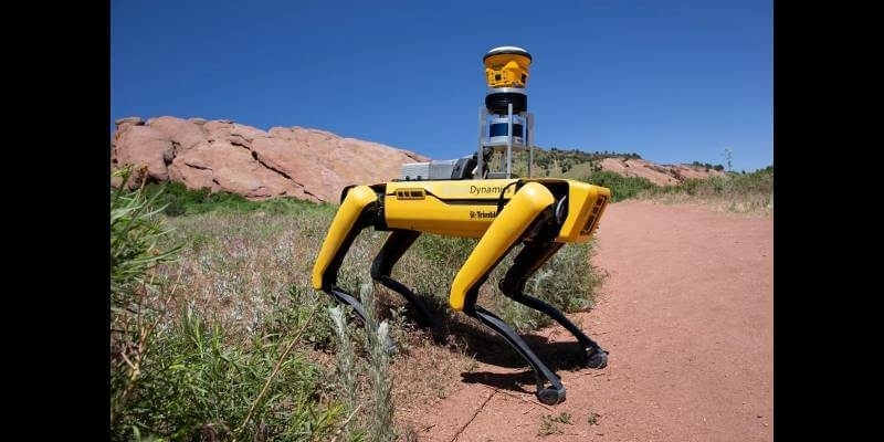
Trimble and Boston Dynamics Announce Strategic Alliance to Extend the Use of Autonomous Robots in Construction
21st October 2020
UP42 Partners With Hexagon To Offer HxGN Content Program Aerial Imagery on Geospatial Marketplace21st October 2020
FutureOn Secures Investment from the Bentley Acceleration Fund to Accelerate Oil & Gas Digitalization
21st October 2020
Bentley Systems expands alliance with Microsoft to accelerate infrastructure digital twin innovations
20th October 2020
Real-Time Data, Ultra-Rugged: Geode GNS2 GPS Receiver20th October 2020
Schneider Electric Releases ArcFM Mobile 11.2.120th October 2020
CGG Launches Walker Ridge Reimaging Program in the Gulf of Mexico
20th October 2020
Inmarsat and Cobham SATCOM enable Maldives fisheries sustainability with Fleet One20th October 2020
Alteia accelerates the deployment of its Enterprise AI Solutions and announces global alliances with GE Digital and Microsoft19th October 2020
Shell Deepwater Selects Bentley’s iTwin Platform for Project Delivery19th October 2020
TDI-Brooks International Completes Ebs Program Offshore Ivory Coast16th October 2020
Smarter Data, Smarter World Conference Agendas Announced16th October 2020
Last call for entries into the 2020 IoT Global Awards16th October 2020
Breakthrough for Mission Critical Services conformance testing as first MCPTT test case successfully evaluated
15th October 2020
Sapcorda Expands Safety-Critical GNSS Augmentation Services for Automotive with powerful L-band Satellite Links15th October 2020
New Topcon robotic total station system built for versatile survey and construction workflow performance