Leica Geosystems, part of Hexagon, announced the latest addition to its Leica Pegasus TRK portfolio of mobile mapping solutions, the Leica Pegasus TRK100.
Specifically designed for GIS professionals, the new mobile mapping system is a powerful, easy-to-use geospatial solution built for large-scale infrastructure measurement and digital twin creation.
The Pegasus TRK portfolio is renowned for its simplicity and ease of use, lightweight robust design, and integration with intelligent, autonomous systems. The Pegasus TRK100 is even lighter and smaller weighing just 14kg, making it easy for just one person to mount on any vehicle. The new mobile mapping system features the same modular hardware approach that allows users to add more cameras to expand the range of use cases.
The Pegasus TRK100 is designed to excel in GIS mapping and asset management applications, providing essential location intelligence for georeferenced visual data. Tailored for GIS professionals, it empowers them to transform their business operations. The system puts control into their hands for quick and autonomous data collection, and asset information capture.
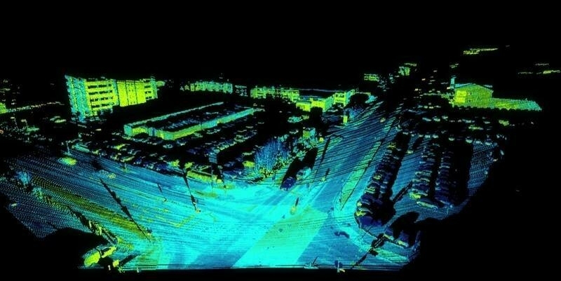
With its advanced mapping capabilities, the Pegasus TRK100 enables GIS professionals to visualise and understand the location of assets, to help make the right decisions, improve asset management, and support infrastructure building and maintenance. The capabilities include MatchPoint for delivering next generation point cloud refinement. This new technology combines AI and a unique learning algorithm to enhance and optimise the clarity of points in post-processing for improved accuracy. The versatility of the Pegasus TRK100 suits a variety of applications in diverse industries, including telecommunications, utilities and road maintenance.
“The Leica Pegasus TRK100 advances autonomy and artificial intelligence in mobile mapping, removing manual process steps and providing actionable insights for informed decision,” said Christian Schäfer, Business Director Mobile Mapping at Leica Geosystems. "It empowers GIS professionals to create the maps they need, collect the information they require and visualise the data in a way that immediately aids understanding.”
This innovative solution will be a featured Tech Highlight at Hexagon’s flagship digital reality solutions conference HxGN Live Global in Las Vegas, NV, from June 12-15, 2023.

Subscribe to our newsletter
Stay updated on the latest technology, innovation product arrivals and exciting offers to your inbox.
Newsletter

