Share
Emlid, the European manufacturer of Reach GNSS receivers, announces an upgrade to its ultralight Reach RX Network RTK rover.
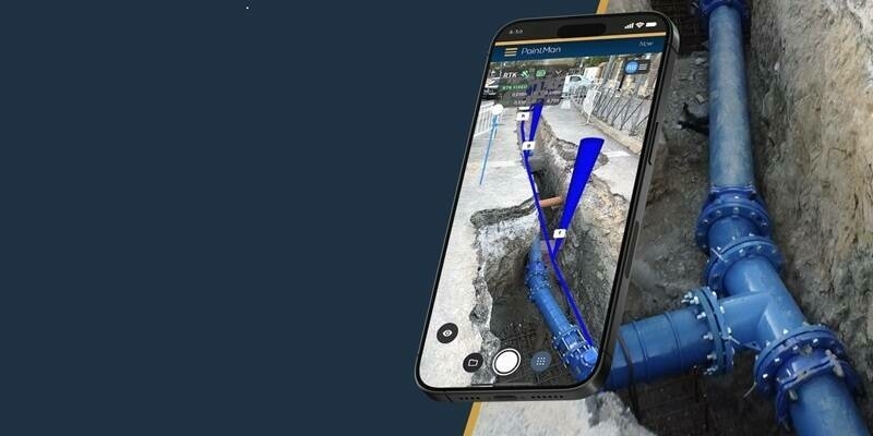
The new generation of devices is updated with MFi (Made for iPhone/iPad) certification and is fully compatible with ArcGIS, QGIS, and other GIS apps for both iOS and Android. Flawless Reach RX integration into GIS workflows will help industry professionals and teams collect accurate geodata at scale.
Centimeter-level accuracy for GIS projects
Emlid Reach RX is an ultralight RTK GNSS rover that provides precise positioning while receiving corrections via NTRIP. The device tracks GPS/QZSS, Galileo, GLONASS, and BeiDou, and it gets a fix in under five seconds, delivering centimeter-level accuracy even in challenging conditions.
The rover doesn't require configuration or additional training—to kick off, surveyors only need to add NTRIP credentials. With its intuitive and straightforward workflow, Reach RX allows anyone on the team to achieve high precision for engineering, utility inspection, landscaping, and other projects of any scale.
The new-gen Reach RX rover integrates with all popular GIS apps on both iOS and Android. Upgraded with MFi certification, it already works with ArcGIS Field Maps and will soon be compatible with QField, Blue Marble’s Global Mapper, Mergin Maps, Avenza Maps, and more.
Subscribe to our newsletter
Stay updated on the latest technology, innovation product arrivals and exciting offers to your inbox.
Newsletter