Share
Bluesky International has completed the most detailed aerial survey of Ireland making it the only company to have acquired full aerial coverage of the Republic of Ireland, England, Scotland and Wales.
The map accurate aerial photography together with 3D terrain mapping will be used to update national contracts with government and commercial organisations and will also feature as part of more than 100,000 square kilometres of imagery data that is now available to view and download from Bluesky’s dedicated online Mapshop for Ireland.
“Taking advantage of the fantastic early spring weather and the relatively low volumes of air traffic we have been able to complete our flying over Ireland,” commented Robert Loughran, International Sales Manager for Bluesky International. “At the same time we have been working hard behind the scenes processing this data so that our online Mapshop has the most up to date content making it the go to place for imagery and height datasets in Ireland.”
On 1st of June 2020 a Bluesky plane completed the last few hours of flying over County Monaghan. Equipped with state of the art survey equipment, Bluesky has now captured more than 80,000 square kilometres of aerial photography in total including selected areas at the higher resolution of 12.5 cm. The large format aerial survey cameras also simultaneously captured Colour Infrared (CIR) imagery. 3D models of the earth’s bare surface (Digital Terrain Model / DTM) and surface features such as buildings and trees (Digital Surface Model / DSM), created by Bluesky’s skilled and experienced team, are also available.
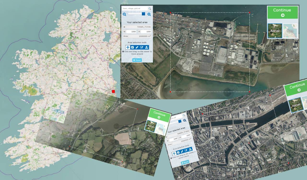
Once processed the 2020 Bluesky data will sit alongside previously captured imagery and height data on the Bluesky Irish Mapshop. Recently updated this online portal now includes up to date (2019) coverage at 25 cm resolution for a number of counties including Carlow, Kilkenny, Waterford and Laois as well as high resolution (12.5 cm) coverage of Dublin and Wexford. The dedicated resource for Ireland allows visitors to search by place name or grid reference, confirm their location using either the photography or a map background before selecting the required data from a list of available options.
Data supplied from the Bluesky Ireland Mapshop is ready for use in a range of desktop mapping, GIS and CAD software and can be securely purchased with a choice of flexible licence options.
https://www.bluesky-world.com/
Subscribe to our newsletter
Stay updated on the latest technology, innovation product arrivals and exciting offers to your inbox.
Newsletter