Ordnance Survey’s Paul French reflects on how Britain’s national mapping agency is measuring up to the aspirations of the COP28 Climate Change Summit

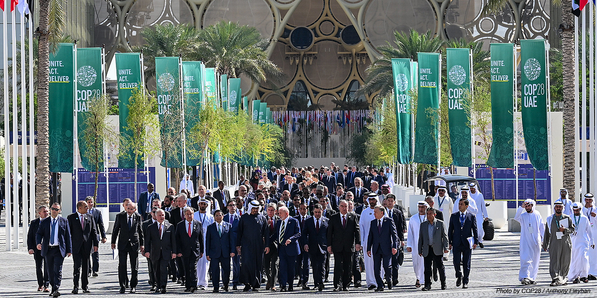
Last month I attended COP 28 in Dubai, alongside a whole team of colleagues from Ordnance Survey (OS). The conference was both alarming and rewarding in equal measure. Alarming in regards to the scale of damage that continues to be caused to the planet, and rewarding in that there is some cause for optimism, and areas where OS can play a significant role.
The UK’s involvement in COP commenced with a keynote speech from His Majesty the King who declared that the world was ‘dreadfully far off track’ on addressing climate change and that the global economy would be in peril unless the environment was rapidly repaired. The King told world leaders that the dangers of climate change were no longer a distant risk and urged them to take more action.
For me personally, the King’s speech was helpful in framing how I thought about my COP attendance and how and where to participate. Public and private sectors have to collaborate effectively to solve the world’s problems; OS is therefore well placed to support the battle against climate change, both in the UK and globally.
Through all the nature, space and financial sessions at COP, it became very clear that location data is key to understanding how to mitigate and adapt to climate change, but also in supporting nature and the ability for green finance to work effectively through baselining and monitoring capabilities.

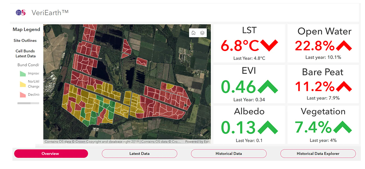
Our demonstration of the OS VeriEarth concept (pictured above) matched the corporate need for high integrity credits to support carbon sequestration and nature projects around the world. Through discussions it also became clear that to meet some of the global declarations, such as increasing global renewables by a third by 2030, needs a good understanding of available land globally and, of course, accurate maps.
The Supply Chain Data Partnership (SCDP), of which OS is a founding member, was launched at COP last year, with the aim of developing and providing critical location insights for assurance of global supply chains. This year, OS and other partners were at COP to update on a major new milestone for the SCDP.
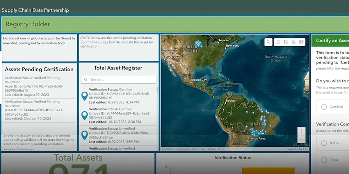
Over the last year, the project has focused on the supply chains of products such as palm oil, soy and wood-based packaging applications and has now successfully completed a proof of concept for a trusted location insights platform. This new platform – a global location register – will enable the monitoring and verification of environmentally and socially sustainable practices at every stage in a supply chain, to protect people and environments.

At the conference, we found this new platform (pictured above) met multiple global needs, from the requirement to decarbonise supply chains to supporting global ambitions on protecting and restoring nature. It also de-risks supply chains and investments and identifies opportunities. The next step will be a much larger coalition of global partners which will be a game-changer in transforming markets into the largest protective force on the planet; it’s a really exciting time.
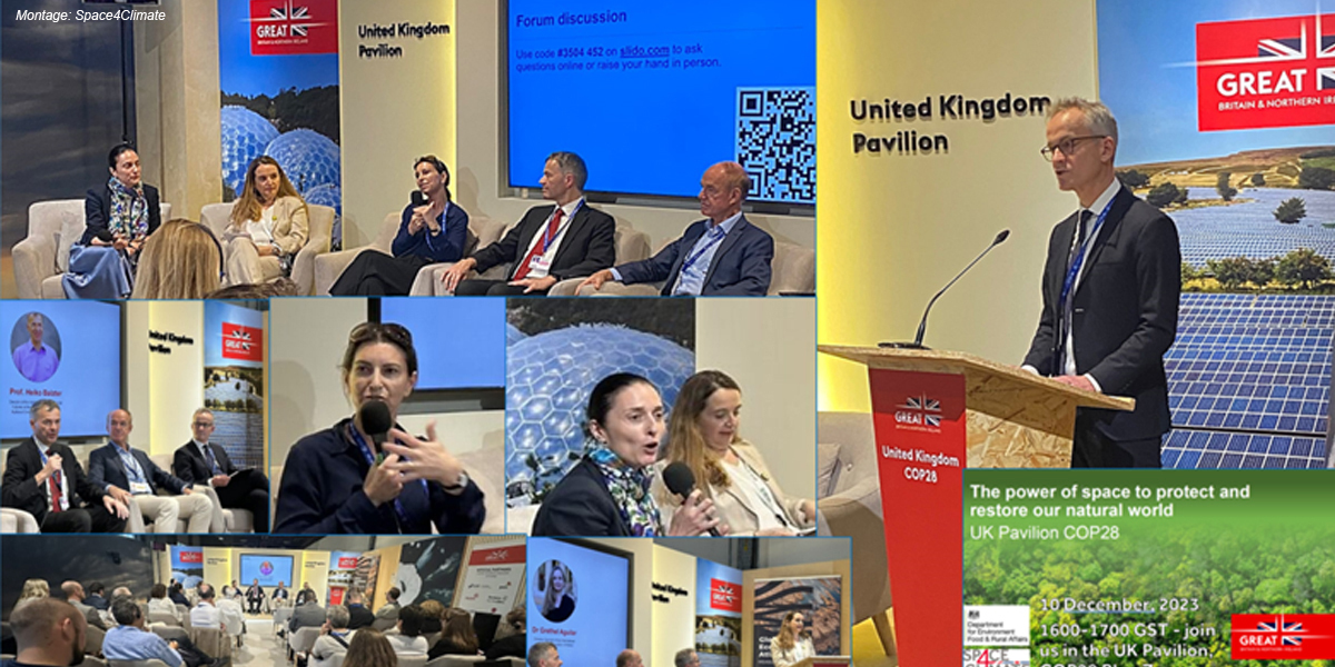
Other stand-out moments for OS were supporting Space4Climate in demonstrating key UK capabilities in satellite missions, sensors, trusted data and standards in the first ever Space Pavilion. Four specific space panel sessions were hosted by the UK Space Agency and DEFRA which aimed to demonstrate leadership in trusted space data and global standards for sensor outputs.

We also had representation at a roundtable event hosted by the King’s Foundation on sustainable urbanisation. COP28 brought the ability to rapidly network and connect with new and existing partners from all over the world, in multiple sectors, and to start enabling location to help solve some of the key challenges around nature and climate.
I spent a lot of my time in the Technology and Innovation, and Energy Transition Hubs. Both of these are areas that OS supports and where we work with clients in Great Britain and internationally. Other highlights included the Dubai Municipality presenting its work on Digital Twins and how it is using data driven insights to reduce emissions, optimising energy use and enhancing urban sustainability. I also met with potential partners covering such topics as the role of sustainability in future cities, the role of financial institutions in decarbonisation, efficient recycling of plastics etc. All of these were fascinating topics; my only nervousness is how quickly they translate into action.
So where do we go after COP28? As COP concludes, there is good news with the inclusion of fossil fuels in the final agreement for the first time. There is global collaboration to support the International Union for Conservation of Nature (IUCN) and Group on Earth Observation (GEO)’s Global Ecosystems Atlas for nature, and linking it to the context geospatial data can provide will enable asset managers to understand their global impact.
We also need to support the renewable pledge by connecting data, analysis and software partners with the funders and move SCDP into Minimum Viable Product status with key partners and customers. Next year we will also see greater collaboration between OS and the UK Space Agency as we try to match space data to the needs of the financial sector. Location is at the heart of these pledges and OS remains committed to sharing our expertise in solving some of these global sustainability challenges.
Paul French is Chief Commercial Officer at Ordnance Survey in Southampton, Hampshire, UK (https://www.ordnancesurvey.co....)
Subscribe to our newsletter
Stay updated on the latest technology, innovation product arrivals and exciting offers to your inbox.
Newsletter

