Share
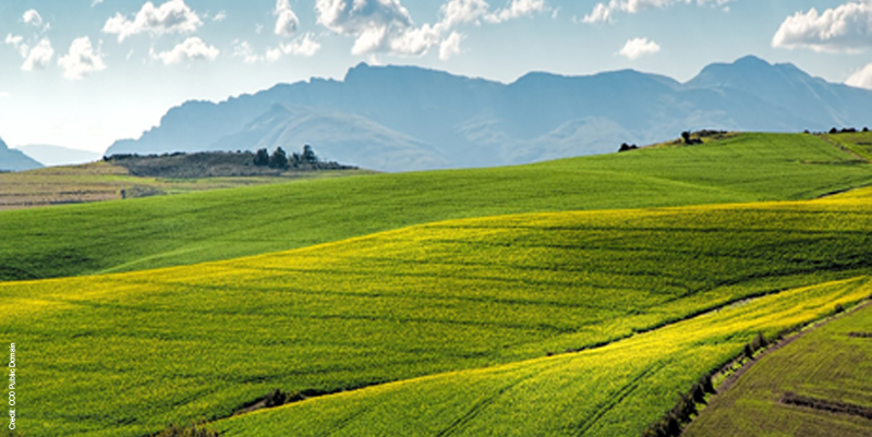
Aarhus University runs the remote Zackenberg Research Station in the northeastern part of Greenland. The station is connected to the surrounding world by satellite telephone, a very thin mail connection and an airplane that arrives every week or every second week – if the weather allows. For the past 18 years, the monitoring programme in Greenland by Zackenberg and Kobbefjord near Nuuk has contributed significantly to knowledge of the ecosystem in the arctic regions. Zackenberg Research Station monitors more than 3,500 different parameters from the high arctic ecosystem at Zackenberg. The data collected covers a variety of information, from the depth of the active layer to the population of birds, and the basic information provided includes high-resolution vegetation maps, hydrological models and snow models. â©
In August last year, COWI was given the job of mapping a large part of the area. The main purpose of this project was to optimise the use of monitoring and research information by providing high resolution data, in particular:â©
The DTM will feed into a large number of research and monitoring efforts at Zackenberg, and will allow for the development of high-resolution hydrological models, as well as feed into models of animal space use and other applications – together with the DTM, both the NIR and colour photos will allow for the development of high resolution, predictive vegetation models for the area, for example.â©
Preparation for UAV mappingâ©
Mapping by UAV was selected instead of traditional aerial mapping by airplane. The mobilisation cost for UAV mapping is less than mapping by airplane so a larger area can be covered before airplane aerial mapping becomes more favourable.â©
The isolated location of Zackenberg requires thorough planning of equipment and back-up material to bring along to the research station. Each potential breakdown of sensors, hardware, software and so on has to be considered and a corresponding backup plan prepared. Even though COWI had previously acquired data in Greenland, there are always unexpected challenges that must be solved on location.â©
Two drones from COWI’s UAV fleet were selected for the task. The intention was to have a high-speed primary drone and a minor drone as backup. The drones were from different suppliers with different software for flying and processing. For each of the drones, additional spare parts were packed together with the expected amount of batteries. Two computers with the same versions of all the software and backup discs for the software were brought – purely as a precaution. The only thing that didn’t have a back up was the GNSS equipment.â©
Going to the fieldâ©
At Zackenberg, the environment and animals have the highest priority, and the field station tries to minimise disturbances to the environment as much as possible. The location of the camp is near the sound in the southern part of the area that was covered. Transport around the area is by foot and all equipment must be carried around. The equipment list for data acquisition by UAV included:â©
- A rifle with eight shots for protection if animals were attacking.â©
- A flare gun for scaring any attacking animals away. â©
- A VHF radio. â©
- A backpack with UAV, computer, additional batteries, spare parts and additional clothes.â©
- GNSS equipment for differential measurements, including two ranging poles for keeping the antenna steady during measurements.â©
The area is split into two parts – one half is rather flat, the other mountainous, with peaks of up to 950m. The terrain was mixed: rocky, with boulders potentially metres in diameter; meadows; lakes; heaths; and so on. â©
To survey the area, we split the flat half into squares measuring 1km x 1km. The squares were kept as guidelines to ensure that the entire area was covered but diversions were often made. When the terrain became steeper, the direction of flight was changed into lines along the equidistance. â©
Testing timesâ©
Upon arrival at Zackenberg, the primary drone was tested. Connection errors between the computer and the UAV occurred continuously and after each connection error, the UAV returned to base. Potential sources of errors and any systemic error messages were investigated. The batteries are sensitive to temperature and to be sure the error had nothing to do with the batteries, they were charged in the building that has the camp’s generator, as this is the warmest location. Furthermore, the charged batteries were kept in a heated container to maintain their temperature. â©
Unfortunately, the cause of error was not eliminated and the backup UAV has to be used for data acquisition.â©
Flying time depended on three different parameters, all related to the power supply. At the camp there is a power supply and 1km into the field, there is another charging point. The charge and (de-charge) of battery time was monitored for each battery to optimise the acquisition:â©
- UAV. Each battery lasts for approximately 35 minutes and the route was planned accordingly. However, altitude and wind had to be taken into account for the execution time, and most power is consumed while flying the UAV up to the required altitude.â©
- Camera. Two batteries were available for each camera. All the batteries had a very different flying period and the time for charging was very long. The flying time had to be estimated according to the batteries of the camera – if the camera battery runs out power, the UAV battery also has to be changed because of the consumption of power during take-off.â©
- Computer. A computer is used for data acquisition and the battery lasts for approximately four hours before it needs recharging.â©
The daily flying time had to be considered and there were two main options. â©
Option oneâ©
Get up very early and trek to the position of flying, to be ready for when the weather conditions permit acceptable pictures. At midday, it is possible to return to the camp to recharge the batteries and then return to the field in the evening to continue acquisition until sunset or the weather conditions prevent good image quality. This provides up to 11 hours in the field and additional time at the office for processing and backing up. â©
Option two â©
Walk to the required location and take the images, when the sun is at the best position for getting the best possible image quality. With this option, there are only eight hours in the field and much less progress in covering the area. â©
In most cases, option two was selected as good image quality is essential in achieving a precise DTM; however, option one was selected to survey locations where the sun only shines in the morning and mountains gives shadow later on. â©
Location problemsâ©
Finding a location for take-off and landing was also problematic. The terrain was closely covered with several stones and it was sometimes difficult to find locations with adequate length and width for landing. The areas covered with grass are also often wet, so there is a risk that the UAV will land in water rather than on the grass. There is also a conflict with muskox as they prefer to graze at the locations where the drone can land. Muskox look very scary and one had to be killed in self-defence last year so they were treated with plenty of respect.â©
At the beginning of August, Zackenberg still has midnight sun and late summer but the weather may change very fast. In the beginning the grass is green but the autumn comes very fast and changes in colour from green to orange and red to brown. To prevent the final orthophoto looking like a patchwork, adjacent areas were covered on consecutive days. On normal flying days, it was possible to cover round 7km² per day, but areas up to 12km² per day were covered with the different methods.â©
First the entire area of 75 km² was surveyed in NIR, so that there would be complete coverage of the area for the DTM. While surveying the area in colour, autumn arrived with three consecutive days of rain and wind. Terrain higher than 300m was covered with snow, so only 50km² could be surveyed in colour.â©
Zackenberg has its own base station for differential GNSS measurements, with natural features used as fixpoints. When the UAV took off, GNSS measurements were taken and two to three natural points surrounding the take-off locations were measured. Additional points were measured to estimate the accuracy of the DTM and orthophotos. â©
Processingâ©
Standard software was used to process the data. The NIR area was split into two parts for processing and the colour area was processed as one complete block.â©
Approximately 10,000 NIR images were taken but only about 9,000 images were used for processing, as some were of poor quality, were occluded by clouds or were too close to mountainous areas. â©
Approximately 7,500 colour images were collected and about 7,000 used to generate the DTM and orthophotos.â©
The accuracy of the DTM in flat areas is about 10cm and higher in steeper and mountainous areas. The accuracy must be taken with caution, as there are lots of stones and terrain is undulating.â©
Conclusionâ©
Acquiring data at a remote area as Zackenberg was just as difficult as expected. Errors occurred with equipment without any indication of the solution and there was limited assistance from colleagues or the reseller. It was a challenge to acquire the data in the same timeframe as normal, as unexpected challenges often occurred and had to be solved quickly on location.â©
In August this year, the Kobbefjord research area will be covered with high-resolution orthophotos and precise DTM information. The experienced at the Zackenberg Research station will be used – but as always, there will be new challenges when mapping in remote areas.â©
Errors occurred with equipment without any indication of the solution and there was limited assistance from colleagues or the resellerâ©
Erik Lysdal is a licensed surveyor at COWI (www.cowi.dk). Niels Martin Schmidt is scientific leader of Zackenberg, Arhus University
Subscribe to our newsletter
Stay updated on the latest technology, innovation product arrivals and exciting offers to your inbox.
Newsletter