Share
A research paper, published today, outlines the creation of a 30m resolution representation of the Earth’s terrain. The resulting Digital Elevation Model (DEM), which is more accurate than any other publicly available, promises a solid basis for the next generation of flood risk maps and models

The paper entitled ‘FathomDEM: An improved global terrain map using a hybrid vision transformer model’ offers an improved method of modeling using a novel application of advanced AI techniques, which halves the error compared to the Digital Elevation Models currently recognised as the most accurate.
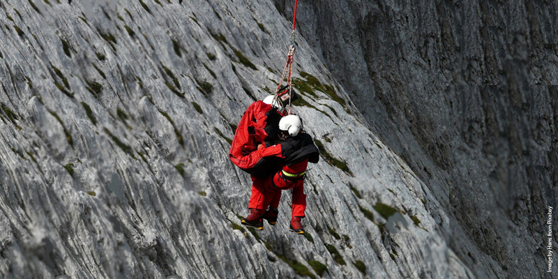
Existing Digital Elevation Models (DEMs) are widely used across a range of sectors from engineering to natural hazards modeling and ecology. But they often suffer from systematic biases caused by instrument error and the presence of trees and buildings on the Earth’s surface, ultimately limiting their effectiveness.
The 'gold standard' for elevation modeling is LiDAR. However, it is only freely available for an estimated 8.2% of the Earth's surface.
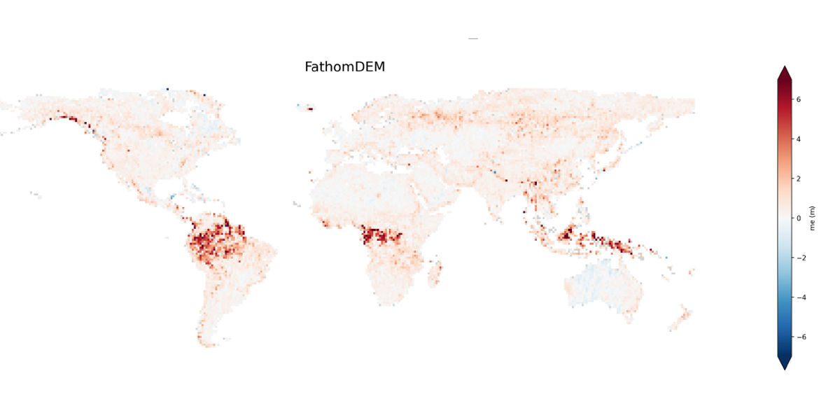
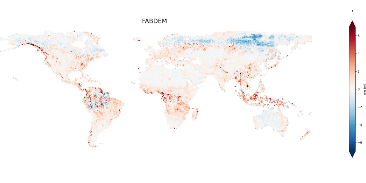
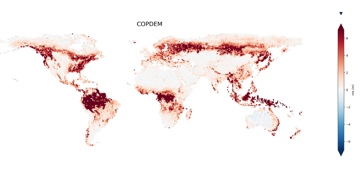
The new model, FathomDEM, removes these surface artifacts from the global radar Digital Elevation Model Copernicus DEM, resulting in an improvement on both global and coastal DEMs.
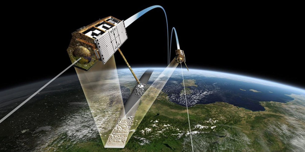
Notably, FathomDEM relies on the novel application of a hybrid vision transformer model – an advanced machine learning technique that removes biases from the underlying terrain measurements by simultaneously predicting corrections for small regions by considering their spatial correlation.
The model is centered around a U-Net neural network design that has proven to be highly effective for similar tasks such as semantic segmentation (pixel-wise classification). The U-Net architecture consists of an encoder network that extracts meaningful features from the input imagery at sequentially larger length scales, and a symmetrical decoder network that up-samples these features to produce the final pixel-wise elevation map prediction. The full encoder–decoder model has approximately 127 million parameters that are adjusted during train time
In short, this new global 30m DEM uses the spatial context of the surrounding landscape instead of a disconnected pixel-by-pixel correction. The result of this process includes:
• Improved accuracy: Removing artifacts commonly found in other global models for a more realistic representation of the Earth’s surface, surpassing existing models in accuracy.
• Novel methodology: Processing the digital elevation model as small images enables better recognition of spatial features.
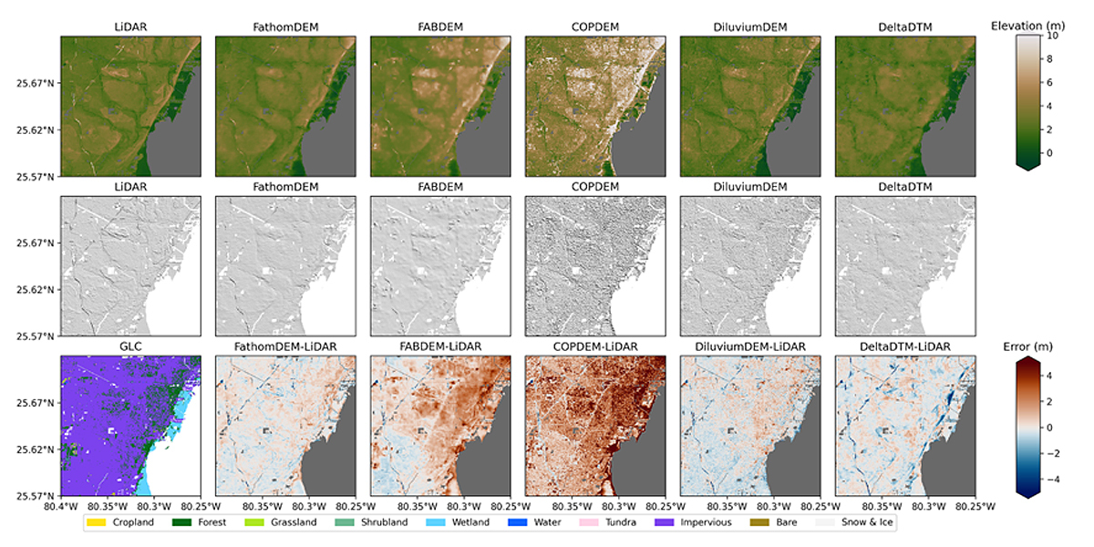
• Extensive inspection: When quantitatively evaluated against a reference dataset of LiDAR, graded against 23 landscape and landcover types, and qualitatively compared to maps from 10 countries, FathomDEM consistently achieved the best evaluation scores.
• Outperforms more specialist digital elevation models: Despite being trained for all terrain types, the model has a stronger performance in low-lying coastal regions than specialist coastal models.
• Validated for flood modeling: Terrain is a key determinant of where water will flow during floods. When tested, the skill of the models based on FathomDEM were of similar quality to the LiDAR-derived flood inundation maps.
Dr Peter Uhe, lead author and Principal Scientific Developer, said: “The AI computer vision tools we used to produce FathomDEM are a step up from previous methods. We’re excited to share this new terrain map which will be a hugely valuable resource for us and the wider academic community.”
Now the research is complete, flood risk intelligence firm Fathom, based in Bristol, UK, will underpin the next iteration of its flood maps with the new Digital Elevation Model - available later this year.
FathomDEM will be available for license commercially from Fathom, and also under a Creative Commons Attribution Non Commercial license for academic research purposes
Story Source: Fathom
Subscribe to our newsletter
Stay updated on the latest technology, innovation product arrivals and exciting offers to your inbox.
Newsletter