Share
Researchers at Aalto University have, for the first time, investigated the occurrence of wolverines across the whole of Finland using satellite imagery, field measurements, and snow track observations.
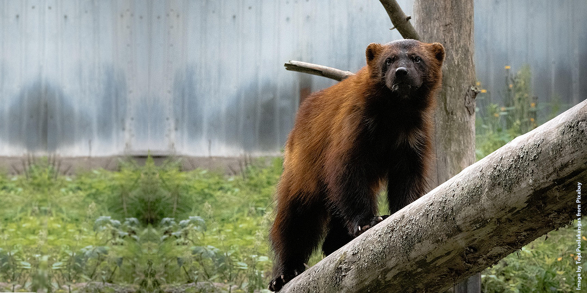
The wolverine, a predator typically found in the fells and forests of northern Finland, was classified as endangered in the country already in the 1980s. Although information on the species' historical range is limited, wolverines are known to have inhabited southern Finland as recently as the 19th century. Hunting caused the species to disappear from the region.
This study, published in the journal Ecology and Evolution, is the first to provide nationwide data on the types of habitats favoured by wolverines as they expand into new areas.
"The species is returning to its historical range in southern Finland. According to our research, the deciduous-dominated mixed forests typical of the south may be more important habitats for wolverines than previously thought," says Pinja-Emilia Lämsä, a doctoral researcher at Aalto University.
Despite recent population growth, the wolverine's survival remains threatened by its small population size, low genetic viability, and fragmented distribution. However, the study's use of remote sensing and field data offers vital information for safeguarding biodiversity. The satellite imagery used in this investigation included Landsat 5 TM and Landsat 7 ETM+ imagery from years 2009–2011 with a spatial resolution of 20 x 20m, and Sentinel-2A MSI, Sentinel-2B MSI, and Landsat 8 OLI from the year 2021 with a spatial resolution of 16 × 16 m.
"Understanding habitats is essential for improving species conservation and management," says Professor Miina Rautiainen, a remote sensing expert at Aalto University.

Pictured above right: A summary of the study … the first to provide nationwide data on the types of habitats favoured by wolverines as they expand into new areas. Credit: Pinja-Emilia Lämsä / Aalto University
Fragmentation of forest landscapes poses a threat
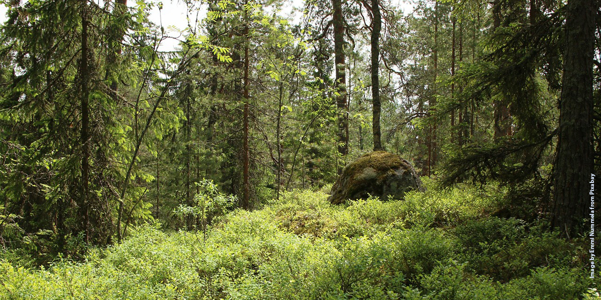
The study found that wolverines tend to favour large, forested areas with deciduous trees. They were rarely observed near recent clear-cuts, whereas older felling sites—about 10 years old—were more attractive. Wolverines also preferred areas with less dense tree cover.
Previous studies on wolverine habitats and distribution have mainly focused on mountainous regions with vegetation that differs significantly from the low-lying boreal forests of Finland. According to Pinja-Emilia Lämsä, it is crucial to understand which habitats wolverines prefer specifically in Finland, where forestry practices strongly influence forest structure.
"In Finland, the average forest compartment—a uniform section of forest in terms of tree species and site conditions—is relatively small. This can lead to a patchwork-like fragmentation of forest landscapes in forest management decisions. To protect wolverine habitats, mixed-species forest should be prioritized and large, continuous forest areas preserved," Lämsä says.
Remote sensing reveals impacts of environmental change
The study, conducted in collaboration with the Natural Resources Institute Finland (Luke), combined snow track counts of wolverines with national forest inventory data based on satellite images and field measurements. This approach allowed the researchers to examine the influence of forest characteristics on wolverine presence on a large scale.
According to Rautiainen, remote sensing is an excellent tool for studying the distribution of animal species across broad areas, as satellite and aerial images provide increasingly detailed information about changes in forest landscapes and their impacts on wildlife.
"In the future, remote sensing will enable us to monitor in even greater detail how, for example, changes in vegetation or other environmental factors in Finland affect animal populations," Rautiainen says.
More information: Pinja‐Emilia Lämsä et al, Wolverines on the Move: A Multi‐Scale Analysis of Forest and Landscape Factors Influencing Wolverine Occurrence in Finland, Ecology and Evolution (2025). DOI: 10.1002/ece3.71300
Journal information: Ecology and Evolution
Story Source: Aalto University
Subscribe to our newsletter
Stay updated on the latest technology, innovation product arrivals and exciting offers to your inbox.
Newsletter