Share
Using existing infrastructure to deploy mobile phone apparatus provides benefits for both UK commercial and government organisations; James Nolan examines how this is being achieved to deliver the digital connectivity needed for smart cities of the future

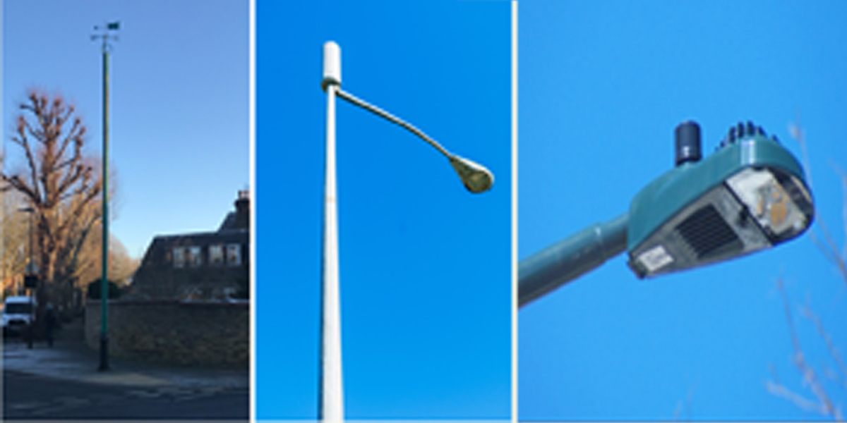
On the corner of a prominent residential street in West London stands a green 12m-tall tubular iron pole. It is topped with a four-point compass and its manufacturer’s name is proudly embossed on its base. Known as a ‘stink pole’ its Victorian function was to remove noxious corrosive gases from sewers built to connect and serve a rapidly expanding urban population. Today, the need to work from home is stretching the demand for digital connectivity beyond current capacity.
Just a few metres from the ‘stink pole’; tall street lights line a busy road where people in offices, hotels and homes compete with shoppers and small businesses for a mobile phone signal. This location is recognised as a capacity ‘not spot’. This network problem is often remedied by attaching a radio antenna or small cell to a lamppost. To tackle these ‘not spots’ in West London, an 18-month infrastructure accelerator pilot was undertaken, its aim being to reduce the time taken to deploy mobile phone infrastructure.
Light speed
From a local authority perspective, knowing where to deploy digital infrastructure is not always clear. Many sites demonstrate high density demand - stadiums, transport hubs, shopping centres and high streets - but no mobile capacity data is available. The mobile operators know where these sites are, but don’t know how to access the street furniture data or gain the required permissions to deploy over a large urban area.
Working to the time frames of companies investing in such deployments meant speeding up the time taken to identify, survey and stress test local authority assets. The pilot began by identifying the entire process needed to achieve a successful deployment. Next came the collection of information relating to those local authority assets needed by the mobile operators and how to deliver it in a secure and uniform way. A group of experienced professionals from both the telecoms industry and local government departments were involved in the entire process.
The method of handling transactions during the pilot relied on the use of an online platform that supplied both detailed spatial data as well as a seamless, auditable transaction process between the mobile operator and local authority. A flexible and scalable platform was used to identify and add suitable electrified sites - including lampposts, EV charge points and bus stops. The platform ensured high visibility of the progress for each application and resulted in a speedy transaction time.
Building the digital twin
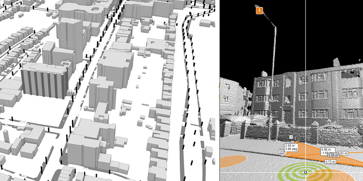
Spatial data for the infrastructure accelerator pilot was drawn from a Geographical Information System (GIS) that covered the sub-region of seven London local authorities. The model was able to tackle all possible sites for deployment. The Ordnance Surveys (OS) MasterMap data model provided complete, precise and spatially-accurate buildings pavements. Unique Property Reference Numbers (UPRNs) for address and location matching were added.
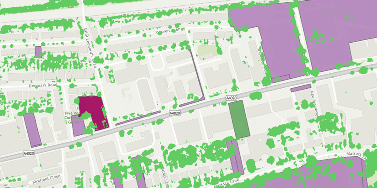
Other key attributes from the mapped data included building height and business counts. These attributes enabled 3D model creation and local demand locations to be established. Data loaded into the GIS from local authorities included lampposts and highways boundaries and publicly-owned land and buildings. Contextual layers of tree canopy cover and restricted area boundaries completed the digital twin.
High density demand areas were identified using mobile phone sample counts of residents, workers and visitors. Displayed across the region as thousands of 350m hexigrids, the data shows where and when sites are busiest. Offices and industrial parks with small businesses attract significant local daytime populations. These areas may have capacity problems in both mobile and fixed connectivity. Cloud-sourced data techniques were used to measure mobile phone coverage. Mobile apps collected geo-referenced download speed statistics; fixed broadband availability at postcode level completed the sub-regional coverage mapping.
Smart City Blocks
The large scale 3D model had the potential to be difficult to use due to data volumes. The system needed to account for users working remotely and from home. There was no problem displaying low level building detail and minimal attributes. Data security and the need for a high degree of spatial precision were the main development considerations. A proprietary web-based mapping solution allowed both user and data segmentation and online GIS functions to be added for site-specific analysis.
The spatial precision of street LA asset registers was tested with the OS MasterMap, and included Global Positioning System (GPS) survey points and captured point cloud data. Attribute data included height and an asset drive-by identifier that was used by both commercial surveyors and asset managers. This enabled specific assets to be booked and, though careful spatial analysis, allowed the establishment of exclusivity zones. Functions of the 3D model included line of sight, radius search and address matching. Proximity to trees, buildings and other sources of possible radio signal interference was established by the spatial precision of the GIS model.
Back to reality
The GIS was also applied in the analysis of sites across the West London sub-region. Census data showed an unsurprising increase in the daytime population due to home working in March 2021, Significantly, the distribution of home workers, people in the same industries, located in the same locations could also be identified with a comparison from 2011 census data. It was here that higher capacity needs would remain for the longer term. Infrastructure companies were not rushing to build in this ‘new geography’ until commuting patterns stabilised. Meanwhile other recent policy and legal requirements are impacting the future roll out plans of radio planners and tower companies. There is therefore much interest in alternative solutions to deliver both digital coverage and capacity as the results of policy changes take effect.
Monitoring transport activity and high street footfall showed local activity picking up and interest from operators grew in deploying to ‘not spots’ at certain high street locations. In some cases, it was clear that situations where buildings created ‘street alleys’ had insufficient signal coverage from existing antennas. The lampposts in situ offered the only solution to bolster network capacity and deployments were quickly effected. Sometimes a series of posts were used; in other locations, a single site was selected.
Mapping the future
In the UK the Ordnance Survey plays a key role in developing a national digital twin by applying existing products and testing new point cloud data capture techniques. Recent developments to ease access to data and, via Geovation initiatives, to give local government planning teams access to the highly valuable OS spatial data have been welcome. However, few commercial companies need to use OS data at the scales on offer. Local government collaboration shows that spatial data, applied correctly, can be the facilitator for real progress toward better digital connectivity.
The demand for higher quality digital connectivity will grow as more users access the burgeoning services provided by innovative public and private sector applications. Recent and continued collaboration between them have demonstrated the value of optimising the infrastructure already in place. It is clear that structures built yesterday can deliver today’s technology. In so doing, the truly smart cities will be ready for the innovations of tomorrow.
James Nolan is a UK-based geospatial consultant working with business and government.
Subscribe to our newsletter
Stay updated on the latest technology, innovation product arrivals and exciting offers to your inbox.
Newsletter